
Floodplain Surveys
Floodplain understanding to assist in your need for flood insurance.
Floodplain Surveys
Floodplain understanding to assist in your need for flood insurance.
Practical Solutions
You may not need it. Without an elevation certificate, your insurance rate defaults to the highest flood risk category.
Are You Paying for Flood Insurance?
You may not need it. Without an elevation certificate, your insurance rate defaults to the highest flood risk category.
This is the first step in determining an accurate need for flood insurance. An Elevation Certificate is evidence of your home's relationship to the flood zones. It is the document your lender and insurance company needs to determine your adjusted rate for flood insurance. Or, it can be the key document in removing the need for flood insurance.
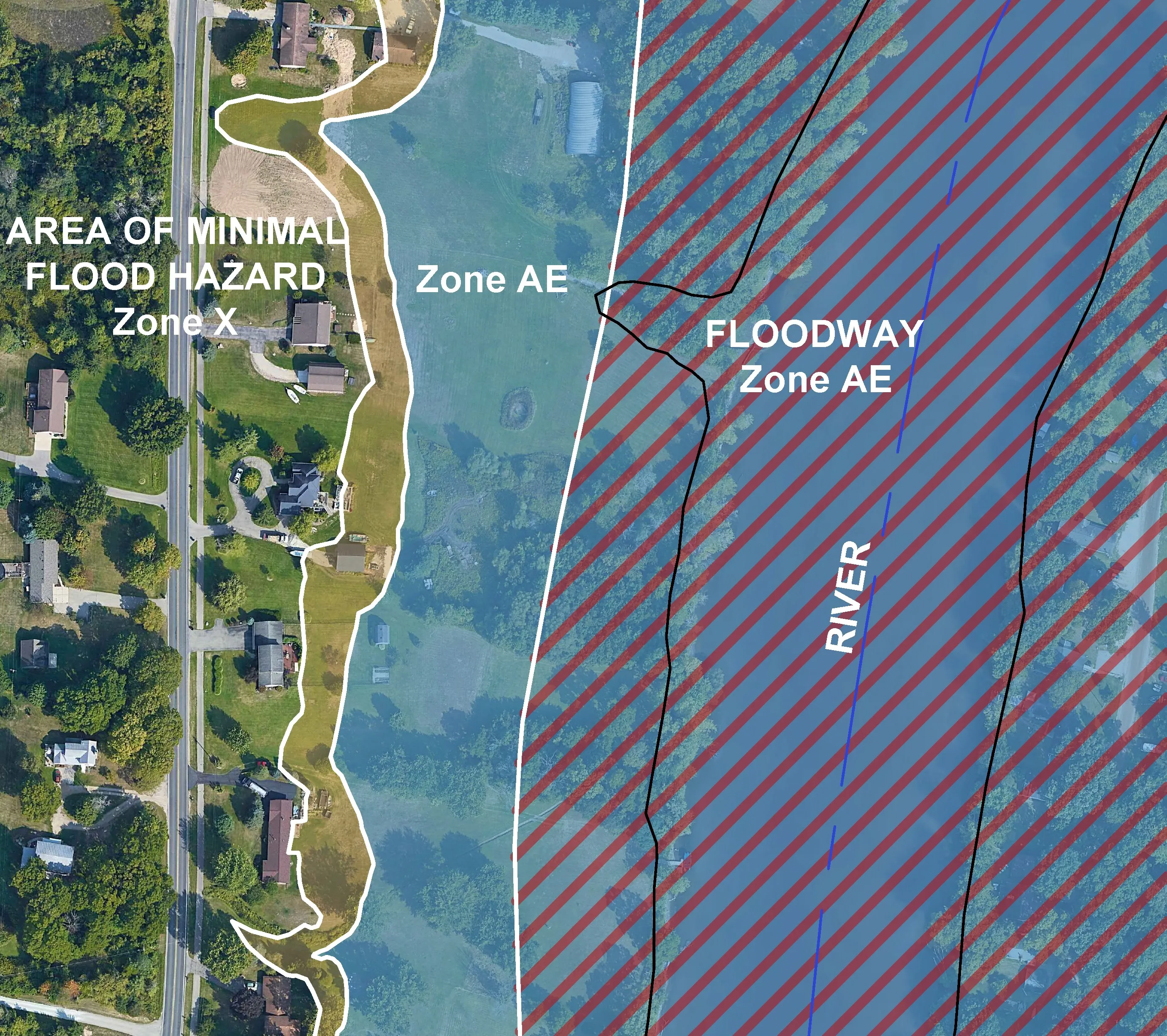
This is the second step in determining an accurate need for flood insurance. The Letter of Map Amendment will amend the Federal Emergency Management Agency (FEMA) flood map to more accurately reflect the conditions of your property. It is prepared by a professional land surveyor and submitted to FEMA for a map revision. Many times a Letter of Map Amendment can completely eliminate the requirement for the home/building owners to pay flood insurance.
Elevation Certificate
This is the first step in determining an accurate need for flood insurance. An Elevation Certificate is evidence of your home's relationship to the flood zones. It is the document your lender and insurance company needs to determine your adjusted rate for flood insurance. Or, it can be the key document in removing the need for flood insurance.
Letter of Map Amendment (LOMA)
This is the second step in determining an accurate need for flood insurance. The Letter of Map Amendment will amend the Federal Emergency Management Agency (FEMA) flood map to more accurately reflect the conditions of your property. It is prepared by a professional land surveyor and submitted to FEMA for a map revision. Many times a Letter of Map Amendment can completely eliminate the requirement for the home/building owners to pay flood insurance.
Floodplain Elevation Surveys
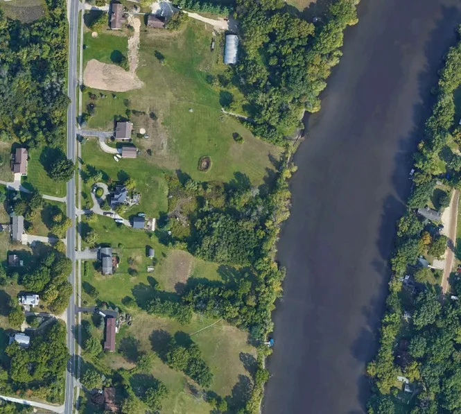
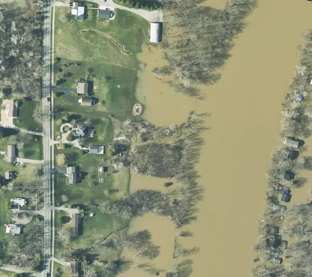
Our qualified professional land surveyors often times will perform a topographical survey to gather the necessary measurements for accurately determining the flood elevations near your home/property. This may be helpful for new construction, understanding your needs for flood insurance, or the possibility of floodplain area modifications. Our Civil Engineering design team has permitted many amendments to floodplain areas in order to accommodate development desires. Don't hesitate to contact us to determine the best solution for your unique situation.
Real People. Real Solutions.

Why Use Nederveld?
Determine Flood Zone Status
We assess your property's elevation and location to identify FEMA-designated flood zones, supporting smart insurance and construction decisions.
Provide Elevation Certificates
FEMA-compliant certificates document your home’s elevation, helping reduce insurance premiums and meet permit requirements.
Protect Long-Term Value, Reducing Risk
Understanding your flood risk empowers better planning, reduces surprises, and protects your property investment over time.
Lower Insurance Costs
Without an Elevation Certificate, you may be overpaying—this document helps you qualify for accurate, reduced flood insurance rates.
Amend FEMA Flood Maps
A professionally prepared Letter of Map Amendment (LOMA) can update FEMA’s records—often eliminating the flood insurance requirement entirely.
Support Development Goals
Floodplain elevation surveys provide the data needed for construction planning, insurance evaluation, or potential floodplain area modifications.
Simple, Practical Solutions - On Your Terms.
Nederveld is a client-centered company that has grown into one of the most diverse engineering-based firms in the country. We provide quality work and invite you to experience the difference with us today!
Our Land Surveying department provides accurate, efficient, and adaptable solutions, ensuring your projects stay on schedule and on point from planning to execution. Our team of dedicated professionals is here to support you every step of the way.