Reality Capture
Capture Existing Conditions with Efficiency, Enhanced Accuracy and Reduced Costs
Transforming Complex Data into Clear Deliverables
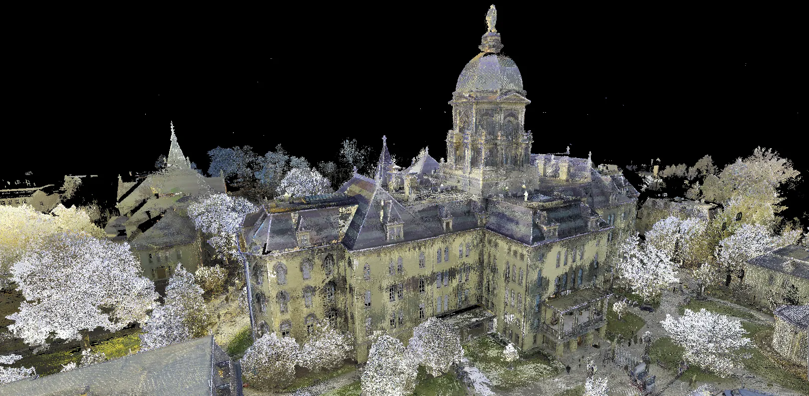
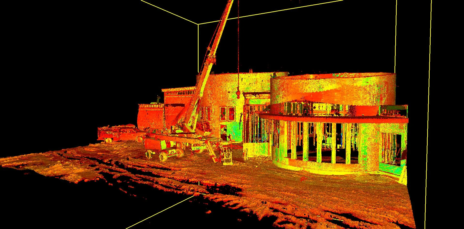
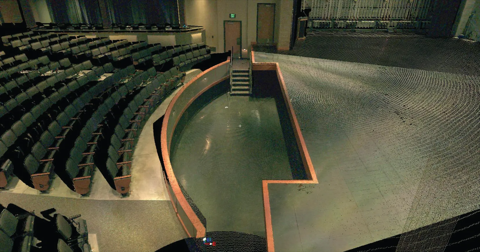
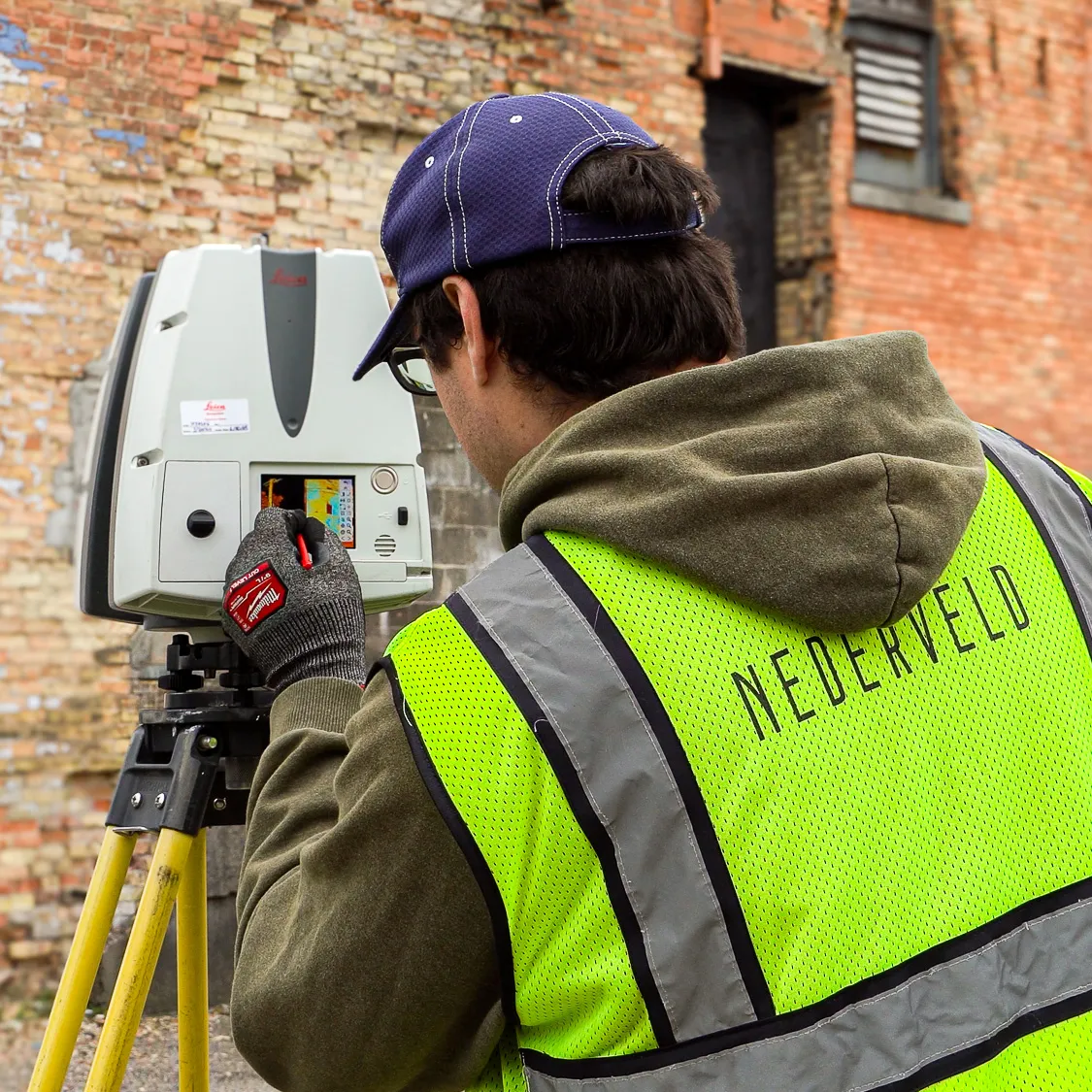
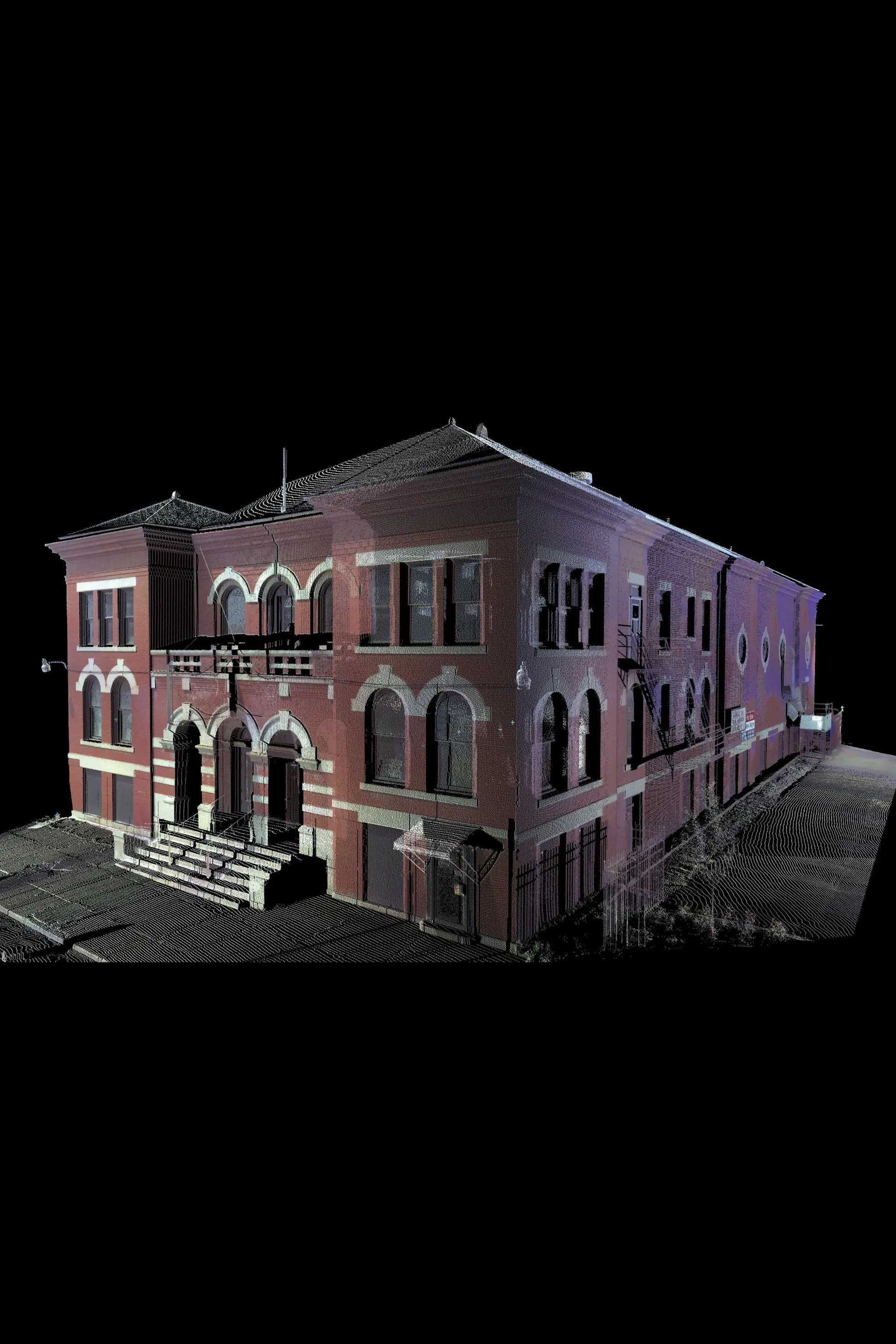
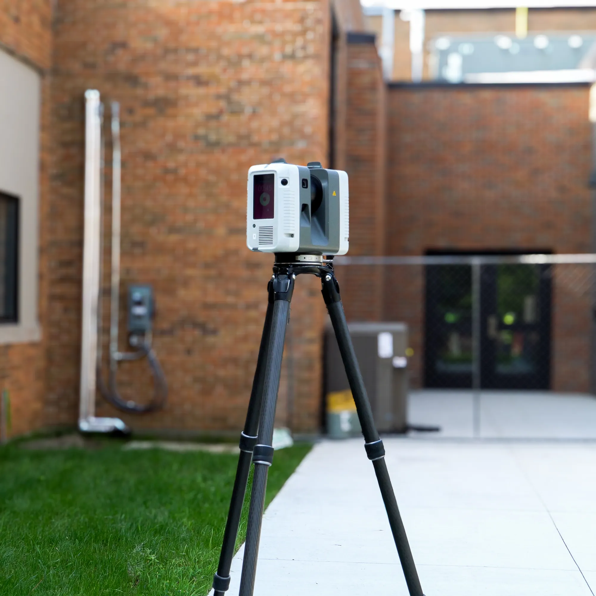
Discrepancies between record drawings and actual site conditions can lead to change orders, delays, and safety risks. Nederveld provides Reality Capture services using 3D laser scanning, LiDAR scanning, and photogrammetry to document existing conditions with speed and precision.
Common Deliverables
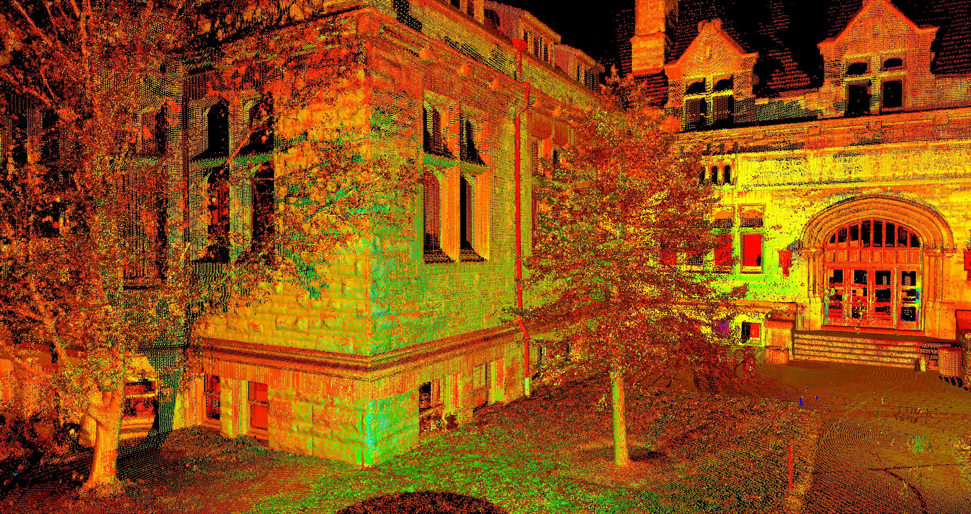
- Point clouds (registered, usable for downstream CAD/BIM workflows)
- As-built documentation / existing conditions documentation
- As-built drawings (when applicable)
- 2D CAD drawings
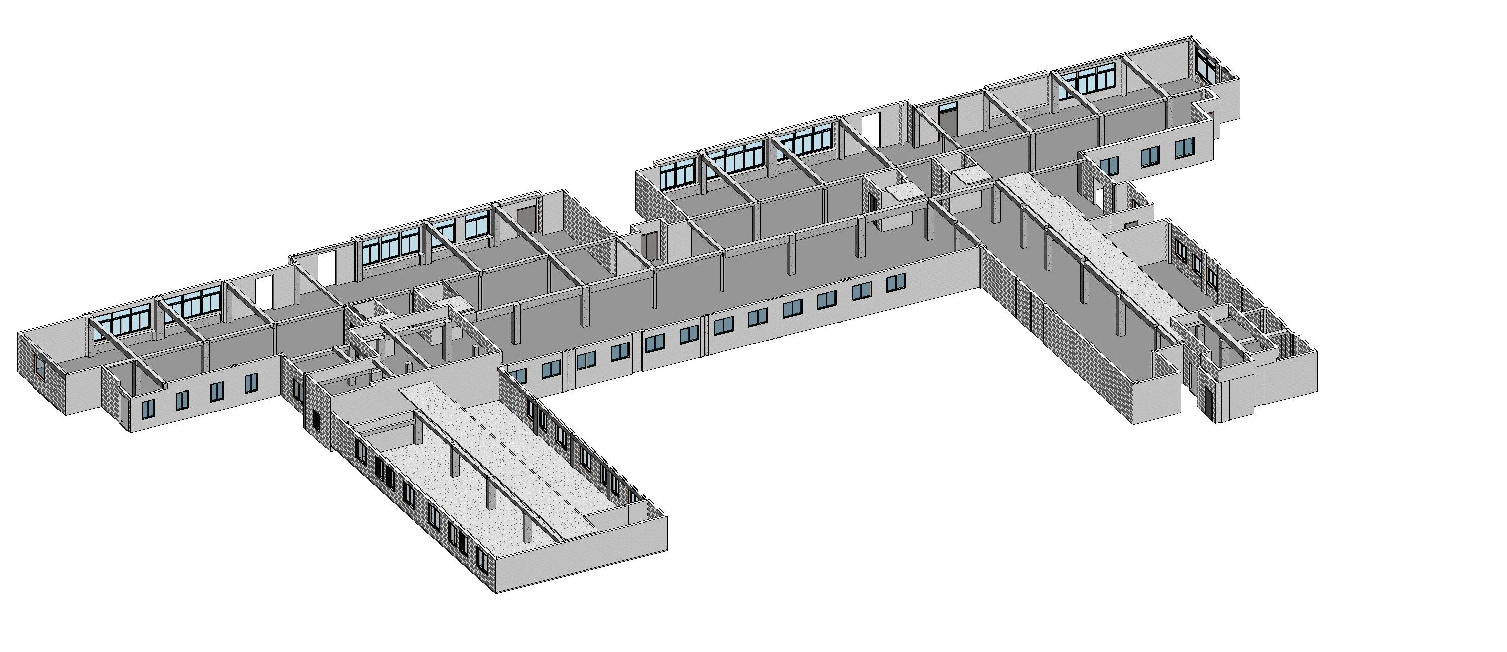
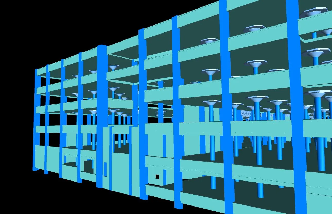
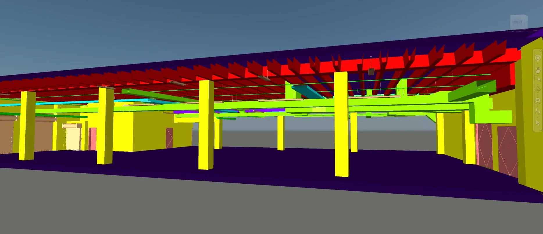
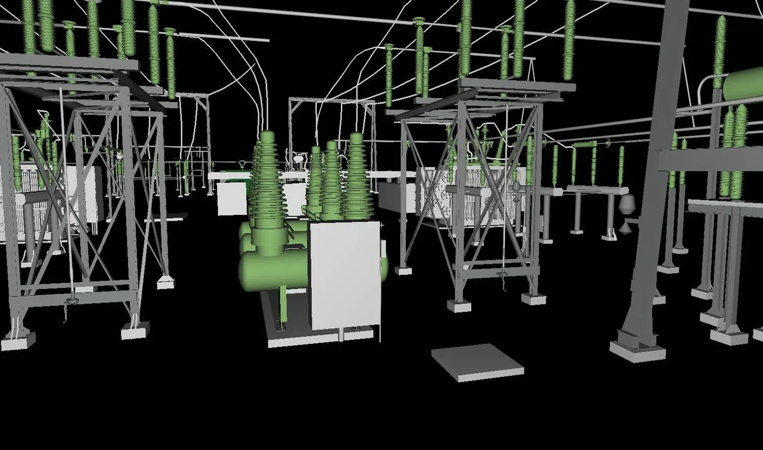
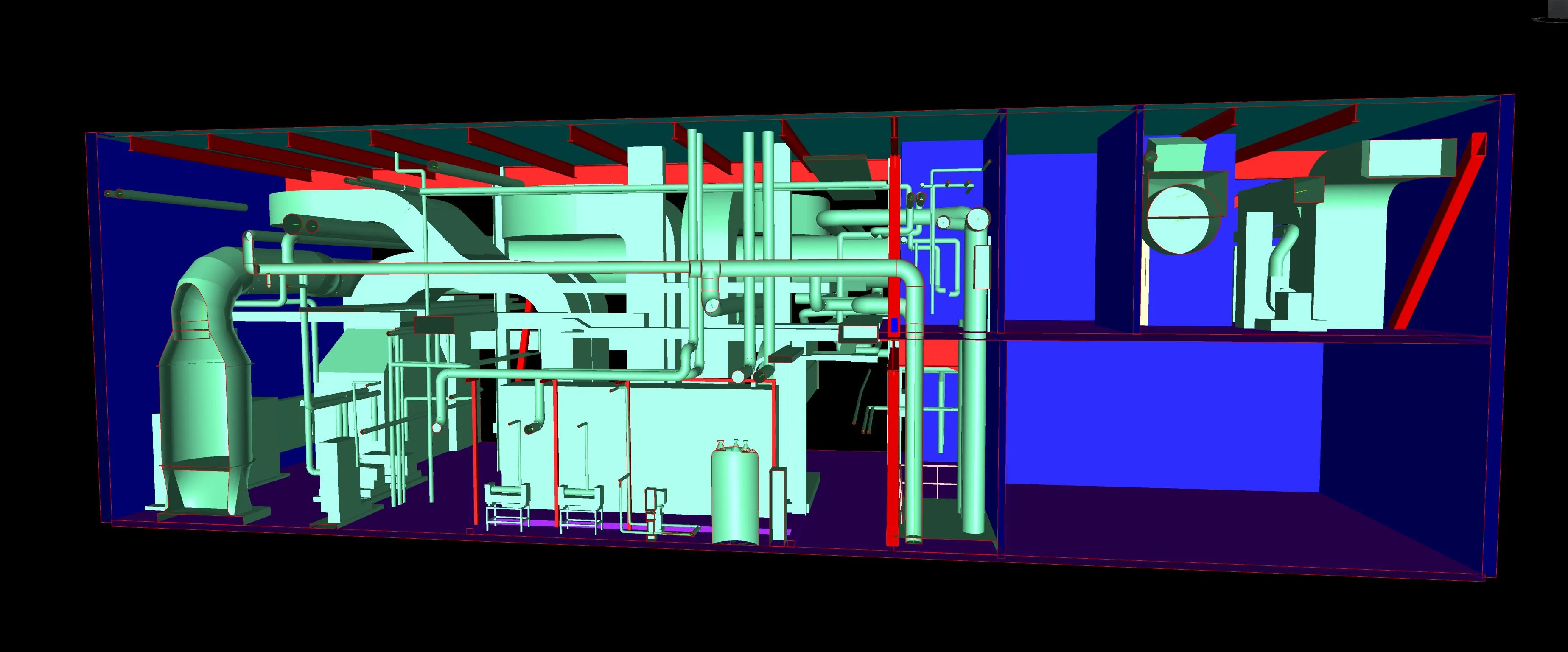
- 3D BIM models
- Scan to BIM outputs
- Scan to Revit outputs
Use Cases
- Existing-conditions validation before design
- Renovation and retrofit planning
- Construction coordination and progress comparison
When would you need Reality Capture services?
Reality Capture documents existing conditions using technologies like 3D laser scanning, LiDAR, photogrammetry, and UAV/drone mapping. By combining survey control with proven field workflows, Nederveld turns real-world conditions into deliverables your team can use for design, coordination, and decision-making.
DOCUMENTING EXISTING CONDITIONS
Reality Capture provides accurate, high-resolution data of current building conditions. It's ideal for renovations, engineering plans, architectural drawings, facility mapping, and historic preservation. Terrestrial scanners and UAVs equipped with LiDAR or photogrammetry tools help reduce field time and improve design accuracy.
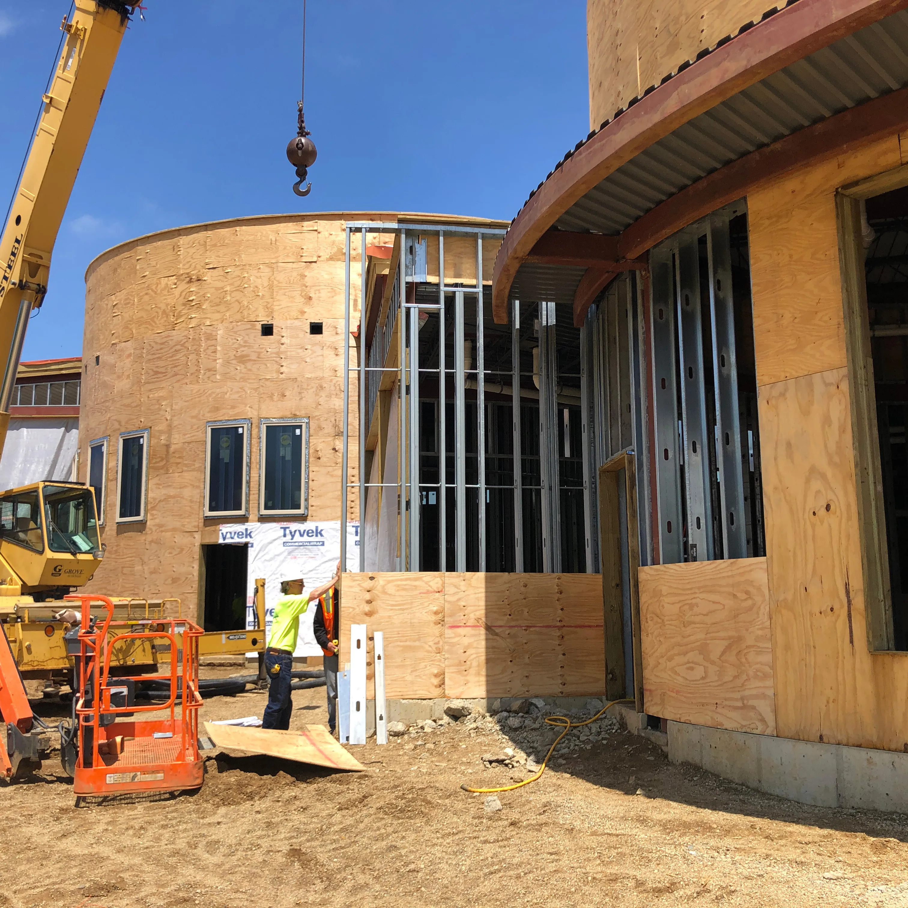
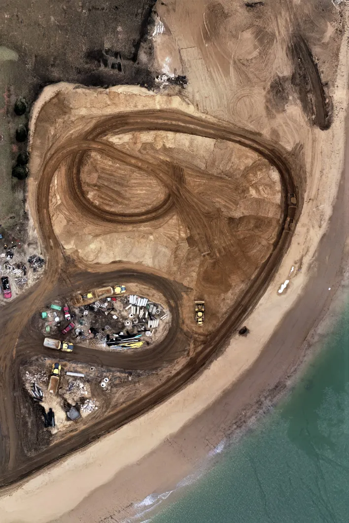
SUPPORTING NEW CONSTRUCTION PROJECTS
Capture and track construction progress from pre-site grading through final inspection. Reality Capture improves coordination, reduces rework, and documents site changes with consistent, reliable visuals that support team communication and quality control efforts.
CREATING ACCURATE DIGITAL MODELS
Through streamlined Scan to BIM workflows, Reality Capture converts real-world environments into intelligent 3D models. These models integrate directly into design and planning processes, helping teams make more informed decisions during early-phase design and retrofit planning.
MEASURING MATERIALS & SITE FEATURES
A fast and reliable option, Reality Capture is ideal for measuring materials like metal panels and stockpiles with precision and minimal disruption. By leveraging drone-mounted scanners UAV and 3D laser documentation, teams get precise measurements without disrupting operations.


Why use Nederveld?
At Nederveld, we believe in the power of human connection. Our extensive team of dedicated professionals is here to support you every step of the way. From initial consultation to project completion and beyond, you will have access to real people who are committed to understanding your specific needs and providing tailored solutions. Our team is available to answer your questions, address your concerns, and ensure a smooth and successful project experience.
Superior Accuracy You Can Trust
By seamlessly integrating land survey principles with advanced reality capture technology, we deliver exceptional results that you can rely on from start to finish.
Real People, Real Support
You won't be left figuring it out alone. From start to finish, our team is here to guide you, answer questions, and ensure a smooth and successful experience.
Fast Response Times
We understand that time is of the essence in any project. Our commitment to providing fast response times ensures that we can mobilize quickly and efficiently to meet your needs.
Nationwide Service Coverage
With nationwide service coverage, we are equipped to handle projects across the country. No matter where your site is located, our team can bring advanced reality capture solutions directly to you.
Extensive Land Survey Expertise
Our deep-rooted knowledge in the land survey business sets us apart in the field of reality capture. This expertise enables us to incorporate precise survey control into our 3D scanning projects, ensuring the highest level of accuracy and reliability in the data we provide.
Real People. Real Solutions.
You’re not sending a message into the void—this form routes your inquiry directly to the Reality Capture team.
Always Evolving, Never Outdated
Leveraging the latest tools and technologies, we deliver simple, practical solutions that are equipped to meet your exact needs and provide clarity where it matters most. Our committed team of experts is available to support you at every stage.
Builds intelligent 3D models for architectural, structural, and MEP design.
Software to aggregate models for clash detection and project coordination.
Supports civil engineering design for grading, utilities, and site development.
Software enabling users to work with point clouds directly inside AutoCAD.
Program to convert reality capture data into 3D models and point clouds.
Software used to draft and edit precise 2D and 3D drawings.
Software giving the ability to combine point cloud data with CAD tools for modeling and mesh creation.
Software to manage and process raw scan data for registration and alignment.
Captures detailed 3D data of physical environments for accurate modeling and analysis.
Additional software to streamline and automate the registration of laser scan data.
Used to capture high-resolution aerial imagery in hard-to-reach areas
Your Solution for Precise Reality Capture
Nederveld is a client-centered company that has grown into one of the most diverse engineering-based firms in the country. We provide quality work and invite you to experience the difference with us today!
Behind every successful scan is a process built on experience and trust. When it comes to Reality Capture, Nederveld delivers unmatched precision backed by extensive land surveying expertise and technical knowledge. Our extensive team of dedicated professionals is here to support you every step of the way.